Showing posts with label maps. Show all posts

2007/07/10

Al Ain Maps - Google Earth File

Trying to find a decent map of Al Ain when we moved here a couple of years ago was an absolute pain. So here is what I have learned since then.

I bought a copy of this one, but it has almost no details. The last time that I was there, copies of it were available at the Hilton gift shop, and I just saw some today at the book store at Al Jimi Mall. The Abu Dhabi Explorer has a map of Al Ain in the back of it as well. It is more detailed than the Geoprojects map, butagain, it is pretty general.

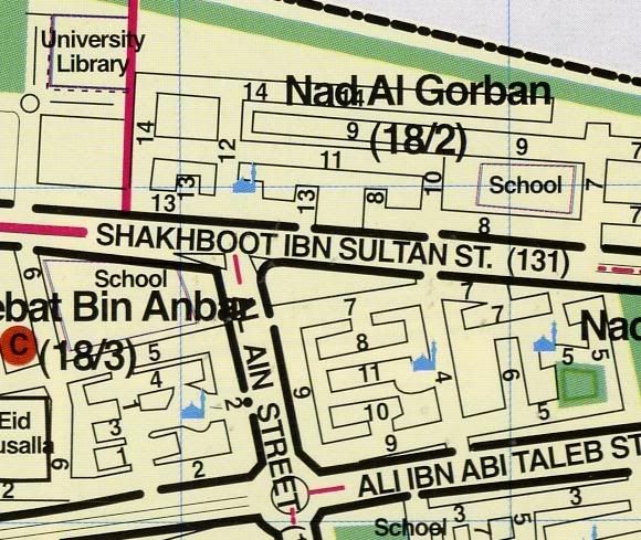
If you can get a copy of this book that was published by the Al Ain Municipality, it is very detailed, listing every street in the city.
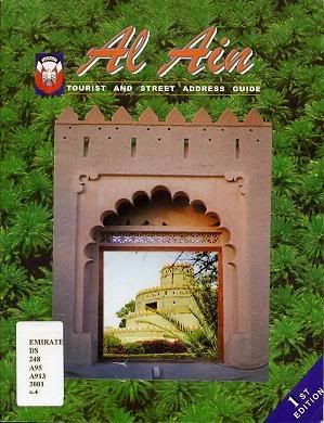


We have ten copies at the university libraries, four at Zayed Central Library. Here is a small section of one of the pages:


There is wikimapia, but in my experience it is filled with "My House" type marking, so it seems to be of limited utility.

Map24 has a pretty detailed map of all the UAE. It lists a lot of the major buildings in town and is searchable.

I have started making a Google Earth file that shows some of the things here. You can download it here. If you have anything that you think should be added to this file, just send me the info and I'll be sure to update it.

2005/09/08

Fun with Google Maps

I was playing around with Google Maps, which is still pretty imcomplete for this area of the world. But you can see some of the things here. Paste these searches to see (you will need to zoom out one level to see anything):

"55.76e 24.09n" - The road up Jabel Hafeet. As you can see, this road is really twisty, like something out of a car commercial.

"55.74e 24.18n" - Al Ain Zoo

"55.77e 24.215n" - The oasis - This is the original oasis that Al Ain grew up around.

"55.754e 24.233n" - Zayed Central Library

"55.601e 24.158n" - Camel Race Track

2005/04/11

Geographic Information

Since I have been asked by several people over the past several months about the size and population of the UAE, I thought that I would put some quick info about it.
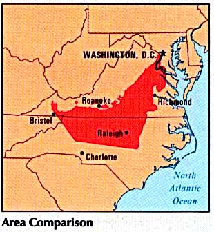
The University of Texas's Perry-Castaneda Library Map Collection has a collection of maps from the CIA Atlas of the Middle East, one of which is a map of the UAE over the southeastern US:


The UAE has a land area of 27,188 square miles. North Carolina has a land area of 48,711 square miles. The UAE has an estimated 3.44 million residents. North Carolina has an estimated population of 8.40 million residents.

There are seven emirates in the UAE. The name of each emirate is also the name of its principal city. Abu Dhabi is the capital city and the largest and richest emirate. It has the the largest percentage of the UAE's oil and natural gas reserves. Dubai is the largest city and the second largest and richest emirate. It has some oil, but most of its wealth comes from trade and banking. The other five emirates are Sharjah, Ajman, Umm Al Qaiwain, Ras Al Khaimah and Fujairah. This map, adapted from the CIA Atlas of the Middle East, shows the boundries of the various emirates


As you can see, Al Ain is the Abu Dhabi emirate. The reason that most emirates are not internally contiguous is that before oil was discovered, most residents were nomadic Bedu had summer and winter territories.

2005/04/09

Satellite Map of Al Ain

I just found this really cool resource: National Geographic Map Machine. Using this, you can see just how green Al Ain is compared to the surrounding desert.